TDRSS scaled map for 1136936
GCN BAT Position Notice
TITLE:           GCN/SWIFT NOTICE
NOTICE_DATE:     Thu 10 Nov 22 02:28:35 UT
NOTICE_TYPE:     Swift-BAT GRB Position
TRIGGER_NUM:     1136936,   Seg_Num: 0
GRB_RA:           29.119d {+01h 56m 29s} (J2000),
                  29.380d {+01h 57m 31s} (current),
                  28.549d {+01h 54m 12s} (1950)
GRB_DEC:         -27.314d {-27d 18' 50"} (J2000),
                 -27.203d {-27d 12' 10"} (current),
                 -27.558d {-27d 33' 28"} (1950)
GRB_ERROR:       3.00 [arcmin radius, statistical only]
GRB_INTEN:       2072 [cnts]    Image_Peak=138 [image_cnts]
TRIGGER_DUR:     1.024 [sec]
TRIGGER_INDEX:   146     E_range: 25-100 keV
BKG_INTEN:       11862 [cnts]
BKG_TIME:        8881.81 SOD {02:28:01.81} UT
BKG_DUR:         8 [sec]
GRB_DATE:        19893 TJD;   314 DOY;   22/11/10
GRB_TIME:        8897.55 SOD {02:28:17.55} UT
GRB_PHI:         -68.63 [deg]
GRB_THETA:        17.70 [deg]
SOLN_STATUS:     0x3
RATE_SIGNIF:     13.37 [sigma]
IMAGE_SIGNIF:    8.01 [sigma]
MERIT_PARAMS:     +1  +0  +0  +0  +2  -2  +0  +0 +68  +0
SUN_POSTN:       225.21d {+15h 00m 49s}  -17.10d {-17d 05' 55"}
SUN_DIST:        133.11 [deg]   Sun_angle= -10.9 [hr] (East of Sun)
MOON_POSTN:       64.38d {+04h 17m 30s}  +23.56d {+23d 33' 37"}
MOON_DIST:        60.98 [deg]
MOON_ILLUM:      97 [%]
GAL_COORDS:      217.40,-75.55 [deg] galactic lon,lat of the burst (or transient)
ECL_COORDS:       15.43,-36.37 [deg] ecliptic lon,lat of the burst (or transient)
COMMENTS:        SWIFT-BAT GRB Coordinates.
COMMENTS:        This is a rate trigger.
COMMENTS:        A point_source was found.
COMMENTS:        This does not match any source in the on-board catalog.
COMMENTS:        This does not match any source in the ground catalog.
COMMENTS:        This is a GRB.
COMMENTS:        This trigger occurred at longitude,latitude = 347.34,18.96 [deg].
GCN BAT Scaled Map Notice
TITLE:           GCN/SWIFT NOTICE
NOTICE_DATE:     Thu 10 Nov 22 02:38:41 UT
NOTICE_TYPE:     Swift-BAT Scaled Map
TRIGGER_NUM:     1136936,   Seg_Num: 0
POINT_RA:         42.233d {+02h 48m 56s} (J2000)
POINT_DEC:       -14.494d {-14d 29' 37"} (J2000)
MAP_DATE:        19893 TJD;   314 DOY;   22/11/10
MAP_TIME:        8897.55 SOD {02:28:17.55} UT
TRIGGER_DUR:     1.024 [sec]
SOLN_STATUS:     0x3
RATE_SIGNIF:     13.37 [sigma]
IMAGE_SIGNIF:    8.01 [sigma]
MAP_URL:         sw01136936000msbsm.fits
SUN_POSTN:       225.21d {+15h 00m 51s}  -17.10d {-17d 06' 02"}
MOON_POSTN:       64.47d {+04h 17m 53s}  +23.58d {+23d 34' 56"}
MOON_ILLUM:      97 [%]
GAL_COORDS:      194.10,-59.88 [deg] galactic lon,lat of the pointing direction
ECL_COORDS:       34.76,-29.24 [deg] ecliptic lon,lat of the pointing direction
COMMENTS:        SWIFT-BAT Scaled Map.
COMMENTS:
COMMENTS:        The next comments were copied from the BAT_POS Notice:
Scaled map image
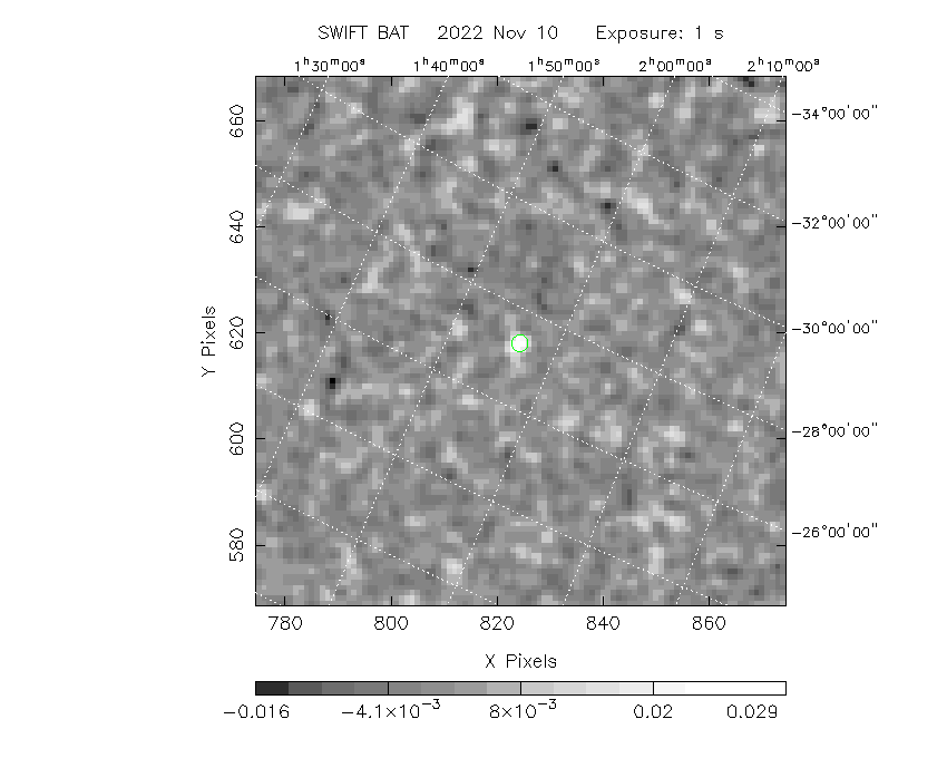
The green circle (6 arcmin radius) is the BAT position (RA, Dec) = (29.119, -27.314).
Search BAT source with the INTEGRAL catalog
known_source_INTEGRAL.sh 29.119 -27.314 1.0
No source found
Results of batcelldetect
# RAcent  DECcent POSerr Theta    Phi  PeakCts   SNR AngSep     Name
#  [deg]    [deg]    ['] [deg]  [deg]                   [']
 76.4194 -23.8414    0.0  33.5 -178.7  -0.0021  -0.4    0.0	XSS J05054-2348
 88.0474  -7.4562    0.0  45.5  156.1  -0.0021  -0.2    0.0	NGC 2110
 29.0944 -27.2652    1.5  17.7  -68.5   0.0324   7.9 ------	UNKNOWN
 65.9702 -59.5365    1.6  48.3 -126.0   0.2278   7.1 ------	UNKNOWN
Search for the BAT bright source catalog
# RAcent  DECcent POSerr Theta    Phi  PeakCts   SNR AngSep     Name
#  [deg]    [deg]    ['] [deg]  [deg]                   [']
 29.0944 -27.2652    1.5  17.7  -68.5   0.0324   7.9 ------	UNKNOWN
 65.9702 -59.5365    1.6  48.3 -126.0   0.2278   7.1 ------	UNKNOWN

Search for UNKNOWN source R.A. = 29.0944 Dec. = -27.2652 (search radius of 3 degrees)
No bright source found.

Search for UNKNOWN source R.A. = 65.9702 Dec. = -59.5365 (search radius of 3 degrees)
No bright source found.
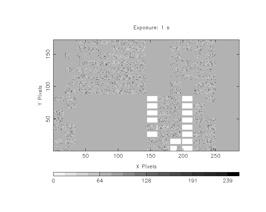
DPI of the combined detector enable/disable map (archived enable/disable map + downloaded data)

DPI of the scaled map
Pixel vs. Counts plot

The data/results are in /local/data/bat1/prebascript/trigger1136936/tdrss_ql/

bat_scaledmap.fits : TDRSS FITS scaled map from GCN
source.img         : Sky FITS image of the scaled map (batfftimage)
source.list        : FITS list of the detected sources (batcelldetect)
scaledmap.log      : Ascii output of the analysis log
bat_pos.reg        : region file for ds9
source.gif         : GIF sky image

Processed time:
Wed Nov  9 21:40:12 EST 2022