TDRSS scaled map for 160672
GCN BAT Position Notice
TITLE:           GCN/SWIFT NOTICE
NOTICE_DATE:     Fri 21 Oct 05 23:32:11 UT
NOTICE_TYPE:     Swift-BAT GRB Position
TRIGGER_NUM:     160672,   Seg_Num: 0
GRB_RA:          126.037d {+08h 24m 09s} (J2000),
                 126.085d {+08h 24m 20s} (current),
                 125.626d {+08h 22m 30s} (1950)
GRB_DEC:         -45.519d {-45d 31' 09"} (J2000),
                 -45.538d {-45d 32' 17"} (current),
                 -45.356d {-45d 21' 22"} (1950)
GRB_ERROR:       4.00 [arcmin radius, statistical only]
GRB_INTEN:       4824 [cnts]    Image_Peak=181 [image_cnts]
TRIGGER_DUR:     1.024 [sec]
TRIGGER_INDEX:   146     E_range: 25-100 keV
BKG_INTEN:       30949 [cnts]
BKG_TIME:        84696.00 SOD {23:31:36.00} UT
BKG_DUR:         8 [sec]
GRB_DATE:        13664 TJD;   294 DOY;   05/10/21
GRB_TIME:        84713.67 SOD {23:31:53.67} UT
GRB_PHI:         -18.68 [deg]
GRB_THETA:        27.32 [deg]
SOLN_STATUS:     0x83
RATE_SIGNIF:     12.80 [sigma]
IMAGE_SIGNIF:    6.77 [sigma]
MERIT_PARAMS:     +1  +0  +0  +0  +2  +2  +0  +1 -25  +1
SUN_POSTN:       206.64d {+13h 46m 34s}  -11.00d {-11d 00' 01"}
SUN_DIST:         75.58 [deg]
MOON_POSTN:       83.44d {+05h 33m 45s}  +28.28d {+28d 16' 38"}
MOON_DIST:        83.36 [deg]
MOON_ILLUM:      78 [%]
GAL_COORDS:      262.68, -4.58 [deg] galactic lon,lat of the burst (or transient)
ECL_COORDS:      150.21,-61.64 [deg] ecliptic lon,lat of the burst (or transient)
COMMENTS:        SWIFT-BAT GRB Coordinates.
COMMENTS:        This is a rate trigger.
COMMENTS:        A point_source was found.
COMMENTS:        This does not match any source in the on-board catalog.
COMMENTS:        This does not match any source in the ground catalog.
COMMENTS:        This is a GRB.
COMMENTS:        Since the IMAGE_SIGNIF is less than 7 sigma, this is a questionable detection.
GCN BAT Scaled Map Notice
TITLE:           GCN/SWIFT NOTICE
NOTICE_DATE:     Fri 21 Oct 05 23:41:57 UT
NOTICE_TYPE:     Swift-BAT Scaled Map
TRIGGER_NUM:     160672,   Seg_Num: 0
POINT_RA:        122.819d {+08h 11m 16s} (J2000)
POINT_DEC:       -18.319d {-18d 19' 06"} (J2000)
MAP_DATE:        13664 TJD;   294 DOY;   05/10/21
MAP_TIME:        84713.47 SOD {23:31:53.47} UT
TRIGGER_DUR:     1.024 [sec]
SUN_POSTN:       206.64d {+13h 46m 34s}  -11.00d {-11d 00' 01"}
SUN_DIST:         80.71 [deg]
MOON_POSTN:       83.44d {+05h 33m 45s}  +28.28d {+28d 16' 38"}
MOON_DIST:        60.23 [deg]
MOON_ILLUM:      78 [%]
GAL_COORDS:      238.53,  8.34 [deg] galactic lon,lat of the pointing direction
ECL_COORDS:      130.29,-37.28 [deg] ecliptic lon,lat of the pointing direction
COMMENTS:        SWIFT-BAT Scaled Map.
COMMENTS:
COMMENTS:        The next comments were copied from the BAT_POS Notice:
COMMENTS:        This is a rate trigger.
COMMENTS:        A point_source was found.
Scaled map image
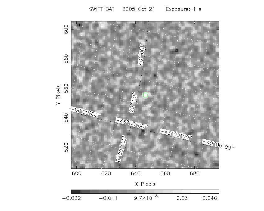
The green circle (6 arcmin radius) is the BAT position (RA, Dec) = (126.037, -45.519).
Search BAT source with the INTEGRAL catalog
known_source_INTEGRAL.sh 126.037 -45.519 1.0
No source found
Results of batcelldetect
Search for the BAT bright source catalog
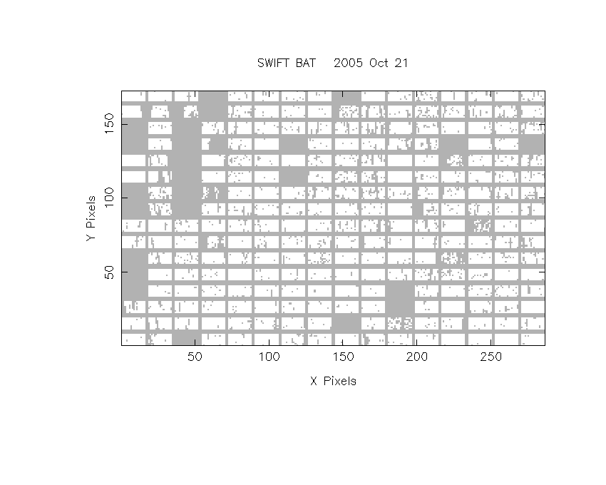
DPI of the combined detector enable/disable map (archived enable/disable map + downloaded data)
DPI of the scaled map

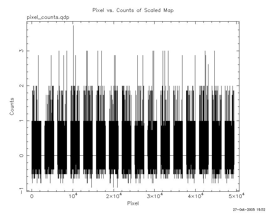
Pixel vs. Counts plot
The data/results are in /local/data/raid2/prebascript/trigger160672/tdrss_ql/

bat_scaledmap.fits : TDRSS FITS scaled map from GCN
source.img         : Sky FITS image of the scaled map (batfftimage)
source.list        : FITS list of the detected sources (batcelldetect)
scaledmap.log      : Ascii output of the analysis log
bat_pos.reg        : region file for ds9
source.gif         : GIF sky image

Processed time:
Thu Oct 27 15:52:34 EDT 2005