TDRSS scaled map for 293924
GCN BAT Position Notice
TITLE:           GCN/SWIFT NOTICE
NOTICE_DATE:     Thu 11 Oct 07 12:40:28 UT
NOTICE_TYPE:     Swift-BAT GRB Position
TRIGGER_NUM:     293924,   Seg_Num: 0
GRB_RA:            8.400d {+00h 33m 36s} (J2000),
                   8.511d {+00h 34m 03s} (current),
                   7.689d {+00h 30m 45s} (1950)
GRB_DEC:         +61.072d {+61d 04' 21"} (J2000),
                 +61.115d {+61d 06' 55"} (current),
                 +60.797d {+60d 47' 49"} (1950)
GRB_ERROR:       3.00 [arcmin radius, statistical only]
GRB_INTEN:       5310 [cnts]    Image_Peak=182 [image_cnts]
TRIGGER_DUR:     1.024 [sec]
TRIGGER_INDEX:   146     E_range: 25-100 keV
BKG_INTEN:       32815 [cnts]
BKG_TIME:        45597.71 SOD {12:39:57.71} UT
BKG_DUR:         8 [sec]
GRB_DATE:        14384 TJD;   284 DOY;   07/10/11
GRB_TIME:        45613.84 SOD {12:40:13.84} UT
GRB_PHI:         145.62 [deg]
GRB_THETA:        36.55 [deg]
SOLN_STATUS:     0x3
RATE_SIGNIF:     16.09 [sigma]
IMAGE_SIGNIF:    7.99 [sigma]
MERIT_PARAMS:     +1  +0  +0  +0  +2  +4  +0  +1 +58  +1
SUN_POSTN:       196.43d {+13h 05m 44s}   -6.99d {-06d 59' 28"}
SUN_DIST:        125.55 [deg]   Sun_angle= -11.5 [hr] (East of Sun)
MOON_POSTN:      198.32d {+13h 13m 16s}  -11.70d {-11d 41' 48"}
MOON_DIST:       130.06 [deg]
MOON_ILLUM:      0 [%]
GAL_COORDS:      120.78, -1.72 [deg] galactic lon,lat of the burst (or transient)
ECL_COORDS:       40.80, 50.80 [deg] ecliptic lon,lat of the burst (or transient)
COMMENTS:        SWIFT-BAT GRB Coordinates.
COMMENTS:        This is a rate trigger.
COMMENTS:        A point_source was found.
COMMENTS:        This does not match any source in the on-board catalog.
COMMENTS:        This does not match any source in the ground catalog.
COMMENTS:        This is a GRB.
COMMENTS:        This trigger occurred at longitude,latitude = 277.70,9.05 [deg].
GCN BAT Scaled Map Notice
TITLE:           GCN/SWIFT NOTICE
NOTICE_DATE:     Thu 11 Oct 07 12:48:52 UT
NOTICE_TYPE:     Swift-BAT Scaled Map
TRIGGER_NUM:     293924,   Seg_Num: 0
POINT_RA:         86.240d {+05h 44m 58s} (J2000)
POINT_DEC:       +59.106d {+59d 06' 22"} (J2000)
MAP_DATE:        14384 TJD;   284 DOY;   07/10/11
MAP_TIME:        45613.84 SOD {12:40:13.84} UT
TRIGGER_DUR:     1.024 [sec]
SOLN_STATUS:     0x3
RATE_SIGNIF:     16.09 [sigma]
IMAGE_SIGNIF:    7.99 [sigma]
MAP_URL:         sw00293924000msbsm.fits
SUN_POSTN:       196.44d {+13h 05m 45s}   -6.99d {-06d 59' 36"}
MOON_POSTN:      198.38d {+13h 13m 32s}  -11.73d {-11d 43' 37"}
MOON_ILLUM:      0 [%]
GAL_COORDS:      153.57, 15.11 [deg] galactic lon,lat of the pointing direction
ECL_COORDS:       87.62, 35.70 [deg] ecliptic lon,lat of the pointing direction
COMMENTS:        SWIFT-BAT Scaled Map.
COMMENTS:
COMMENTS:        The next comments were copied from the BAT_POS Notice:
Scaled map image
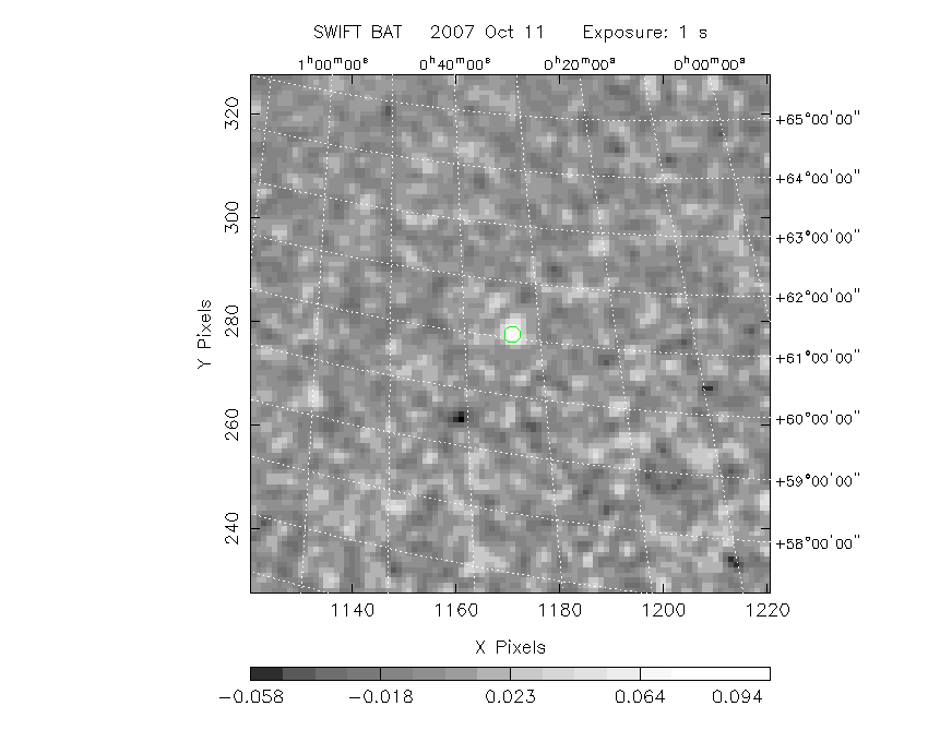
The green circle (6 arcmin radius) is the BAT position (RA, Dec) = (8.400, +61.072).
Search BAT source with the INTEGRAL catalog
known_source_INTEGRAL.sh 8.400 +61.072 1.0
IGRJ00370+6122  (   9.275 ,  61.367 )     delta= 0.514
Results of batcelldetect
# RAcent  DECcent POSerr Theta    Phi  PeakCts   SNR AngSep     Name
#  [deg]    [deg]    ['] [deg]  [deg]                   [']
  6.9262  59.3037   12.1  38.2  143.9   0.0148   0.9    8.5	V709 Cas
 19.6569  65.3702   90.1  30.1  148.5  -0.0013  -0.1    6.0	4U 0114+65
 52.6703  43.9023  234.0  25.4   86.4   0.0005   0.0    5.6	GK Per
 53.7335  53.1625   18.7  18.8  104.1   0.0056   0.6    0.9	V0332+53
 58.7240  31.1259    5.4  33.5   63.9  -0.0329  -2.1    7.8	X Per
 83.5209  21.9435    4.0  37.2   22.4   0.0355   2.9    7.6	Crab
 93.5994  70.9228    4.3  12.2 -150.4   0.0193   2.7    9.1	Mkn 3
 94.1807   9.2648   11.7  50.2    8.0   0.0220   1.0    9.7	4U 0614+091
133.6327  39.4627    7.4  35.5  -59.7   0.0194   1.6    5.4	NGC 2691
167.1383  72.6103    5.6  32.5 -128.5  -0.0194  -2.0    8.3	NGC 3516
331.9525  54.5215  450.6  54.8  157.9   0.0016   0.0    1.0	4U 2206+54
  8.3889  61.0989    1.6  36.5  145.7   0.1023   7.4 ------	UNKNOWN
 55.1264  64.7209    2.6  15.5  142.5   0.0333   4.4 ------	UNKNOWN
311.6915  62.0606    2.5  53.9  173.8   0.1350   4.6 ------	UNKNOWN
139.0785  26.5300    2.4  48.6  -53.6   0.2426   4.9 ------	UNKNOWN
Search for the BAT bright source catalog
# RAcent  DECcent POSerr Theta    Phi  PeakCts   SNR AngSep     Name
#  [deg]    [deg]    ['] [deg]  [deg]                   [']
 83.5209  21.9435    4.0  37.2   22.4   0.0355   2.9    7.6	Crab
  8.3889  61.0989    1.6  36.5  145.7   0.1023   7.4 ------	UNKNOWN
 55.1264  64.7209    2.6  15.5  142.5   0.0333   4.4 ------	UNKNOWN
311.6915  62.0606    2.5  53.9  173.8   0.1350   4.6 ------	UNKNOWN
139.0785  26.5300    2.4  48.6  -53.6   0.2426   4.9 ------	UNKNOWN

Search for UNKNOWN source R.A. = 8.3889 Dec. = +61.0989 (search radius of 3 degrees)
No bright source found.

Search for UNKNOWN source R.A. = 55.1264 Dec. = +64.7209 (search radius of 3 degrees)
No bright source found.

Search for UNKNOWN source R.A. = 139.0785 Dec. = +26.5300 (search radius of 3 degrees)
No bright source found.

Search for UNKNOWN source R.A. = 311.6915 Dec. = +62.0606 (search radius of 3 degrees)
No bright source found.
DPI of the combined detector enable/disable map (archived enable/disable map + downloaded data)

DPI of the scaled map

Pixel vs. Counts plot

The data/results are in /local/data/raid2/prebascript/trigger293924/tdrss_ql/

bat_scaledmap.fits : TDRSS FITS scaled map from GCN
source.img         : Sky FITS image of the scaled map (batfftimage)
source.list        : FITS list of the detected sources (batcelldetect)
scaledmap.log      : Ascii output of the analysis log
bat_pos.reg        : region file for ds9
source.gif         : GIF sky image

Processed time:
Thu Oct 11 08:50:43 EDT 2007