TDRSS scaled map for 518792
GCN BAT Position Notice
TITLE:           GCN/SWIFT NOTICE
NOTICE_DATE:     Wed 28 Mar 12 03:10:08 UT
NOTICE_TYPE:     Swift-BAT GRB Position
TRIGGER_NUM:     518792,   Seg_Num: 0
GRB_RA:          241.550d {+16h 06m 12s} (J2000),
                 241.756d {+16h 07m 01s} (current),
                 240.710d {+16h 02m 50s} (1950)
GRB_DEC:         -39.340d {-39d 20' 24"} (J2000),
                 -39.373d {-39d 22' 20"} (current),
                 -39.206d {-39d 12' 20"} (1950)
GRB_ERROR:       3.00 [arcmin radius, statistical only]
GRB_INTEN:       6269 [cnts]    Image_Peak=191 [image_cnts]
TRIGGER_DUR:     1.408 [sec]
TRIGGER_INDEX:   472     E_range: 25-100 keV
BKG_INTEN:       61222 [cnts]
BKG_TIME:        11151.96 SOD {03:05:51.96} UT
BKG_DUR:         16 [sec]
GRB_DATE:        16014 TJD;    88 DOY;   12/03/28
GRB_TIME:        11179.03 SOD {03:06:19.03} UT
GRB_PHI:           2.22 [deg]
GRB_THETA:        10.84 [deg]
SOLN_STATUS:     0x83
RATE_SIGNIF:     13.19 [sigma]
IMAGE_SIGNIF:    6.57 [sigma]
MERIT_PARAMS:     +1  +0  +0  +0  +2  -4  +0  +1 +48  +0
SUN_POSTN:         7.21d {+00h 28m 50s}   +3.11d {+03d 06' 45"}
SUN_DIST:        118.83 [deg]   Sun_angle= 8.4 [hr] (West of Sun)
MOON_POSTN:       66.25d {+04h 25m 00s}  +21.47d {+21d 28' 16"}
MOON_DIST:       161.69 [deg]
MOON_ILLUM:      25 [%]
GAL_COORDS:      339.02,  9.52 [deg] galactic lon,lat of the burst (or transient)
ECL_COORDS:      247.19,-18.13 [deg] ecliptic lon,lat of the burst (or transient)
COMMENTS:        SWIFT-BAT GRB Coordinates.
COMMENTS:        This Notice was delayed by more than 60 sec past the end of the trigger integration interval;
COMMENTS:        probably due to it occurring during a Malindi downlink session.
COMMENTS:        This is a rate trigger.
COMMENTS:        A point_source was found.
COMMENTS:        This does not match any source in the on-board catalog.
COMMENTS:        This does not match any source in the ground catalog.
COMMENTS:        This is a GRB.
COMMENTS:        Since the IMAGE_SIGNIF is less than 7 sigma, this is a questionable detection.
GCN BAT Scaled Map Notice
TITLE:           GCN/SWIFT NOTICE
NOTICE_DATE:     Wed 28 Mar 12 03:18:35 UT
NOTICE_TYPE:     Swift-BAT Scaled Map
TRIGGER_NUM:     518792,   Seg_Num: 0
POINT_RA:        246.897d {+16h 27m 35s} (J2000)
POINT_DEC:       -29.418d {-29d 25' 05"} (J2000)
MAP_DATE:        16014 TJD;    88 DOY;   12/03/28
MAP_TIME:        11179.03 SOD {03:06:19.03} UT
TRIGGER_DUR:     1.408 [sec]
SOLN_STATUS:     0x83
RATE_SIGNIF:     13.19 [sigma]
IMAGE_SIGNIF:    6.57 [sigma]
MAP_URL:         sw00518792000msbsm.fits
SUN_POSTN:         7.21d {+00h 28m 51s}   +3.11d {+03d 06' 53"}
MOON_POSTN:       66.33d {+04h 25m 18s}  +21.48d {+21d 28' 34"}
MOON_ILLUM:      25 [%]
GAL_COORDS:      349.37, 13.37 [deg] galactic lon,lat of the pointing direction
ECL_COORDS:      249.83, -7.58 [deg] ecliptic lon,lat of the pointing direction
COMMENTS:        SWIFT-BAT Scaled Map.
COMMENTS:
COMMENTS:        The next comments were copied from the BAT_POS Notice:
Scaled map image
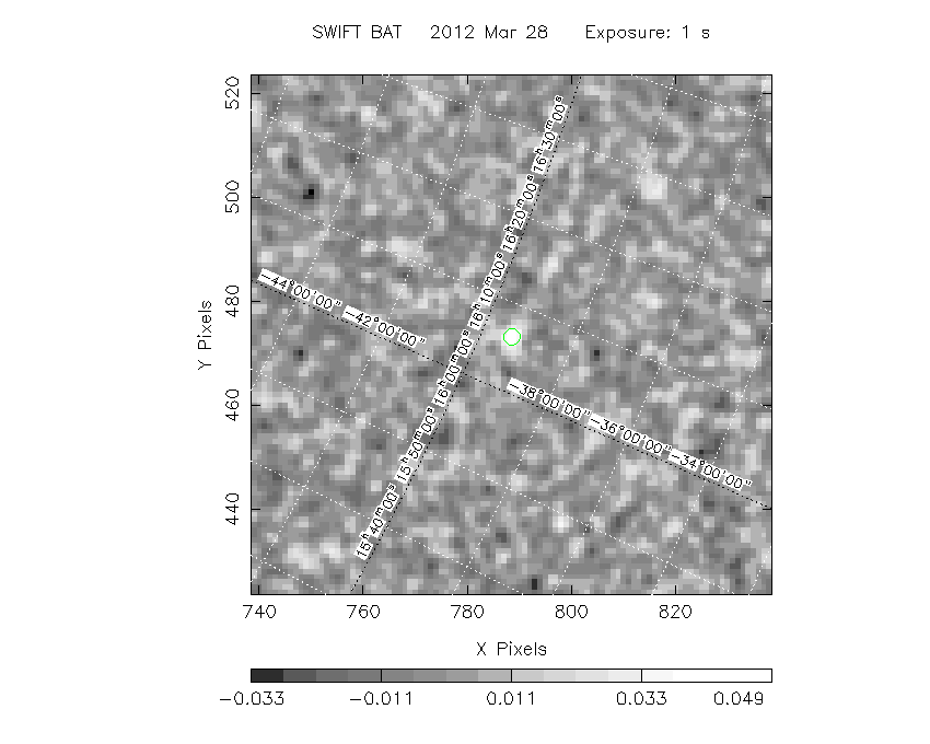
The green circle (6 arcmin radius) is the BAT position (RA, Dec) = (241.550, -39.340).
Search BAT source with the INTEGRAL catalog
known_source_INTEGRAL.sh 241.550 -39.340 1.0
No source found
Results of batcelldetect
# RAcent  DECcent POSerr Theta    Phi  PeakCts   SNR AngSep     Name
#  [deg]    [deg]    ['] [deg]  [deg]                   [']
172.6417 -62.9308    0.0  57.0   11.2  -0.1416  -1.6    0.0	IGR J11305-6256
176.8692 -61.9539    0.0  55.0   12.4  -0.0693  -1.2    0.0	1E 1145.1-6141
177.0001 -62.2069    0.0  55.0   12.1   0.0412   0.8    0.0	4U 1145-61
177.1387 -67.7500    0.0  55.3    5.3   0.0649   1.4    0.0	EXO 0748-676
186.6567 -62.7703    0.0  50.6   10.7  -0.0078  -0.3    0.0	GX 301-2
188.9026 -39.9093    0.0  48.0   40.8   0.0150   0.3    0.0	NGC 4507
195.6985 -63.8357    0.0  47.0    7.7  -0.0086  -0.4    0.0	PSR B1259-63
196.3645 -49.4682    0.0  42.8   27.3   0.0010   0.1    0.0	NGC 4945
201.3651 -43.0191    0.0  38.6   36.4  -0.0026  -0.1    0.0	Cen A
201.6504 -62.1361    0.0  43.9    8.3   0.0189   1.1    0.0	4U 1323-619
207.3302 -30.3094    0.0  34.1   58.2   0.0148   0.9    0.0	IC 4329A
213.2913 -65.3390    0.0  41.5    0.1  -0.0016  -0.1    0.0	Cir Galaxy
213.3119  -3.2075    0.0  41.2  102.8  -0.0318  -0.5    0.0	NGC 5506
228.4837 -59.1356    0.0  32.3   -2.6  -0.0149  -1.4    0.0	PSR B1509-58
231.2913 -65.3390    0.0  37.2   -9.6  -0.0170  -1.4    0.0	Circinus AGN
235.5971 -52.3861    0.0  24.4   -3.5   0.0060   0.6    0.0	H 1538-522
243.1792 -52.4231    0.0  23.2  -14.5   0.0283   2.9    0.0	4U 1608-522
243.1792 -57.1669    0.0  27.9  -16.0  -0.0069  -0.7    0.0	Cir X-1
244.9795 -15.6402    0.0  13.9  152.0   0.0026   0.3    0.0	Sco X-1
248.0700 -67.4619    0.0  38.0  -21.0   0.0067   0.5    0.0	4U 1626-67
250.2312 -53.7514    0.0  24.4  -25.1   0.0239   2.4    0.0	4U 1636-536
251.4487 -45.6111    0.0  16.6  -31.5   0.0129   1.3    0.0	GX 340+0
253.5006 -39.8458    0.0  11.7  -46.0  -0.0036  -0.4    0.0	GRO J1655-40
255.1996 -41.6731    0.0  14.0  -46.8  -0.0051  -0.6    0.0	OAO 1657-415
255.9866 -37.8441    0.0  11.3  -59.8   0.0047   0.5    0.0	4U 1700-377
256.4354 -36.4231    0.0  10.6  -66.6   0.0078   0.9    0.0	GX 349+2
256.5638 -43.0361    0.0  15.7  -47.3  -0.0149  -1.6    0.0	4U 1702-429
257.2292 -44.1000    0.0  16.8  -46.7  -0.0005  -0.0    0.0	4U 1705-440
257.2333 -32.2833    0.0   9.3  -89.8  -0.0039  -0.4    0.0	4U 1705-32
257.2750 -36.4108    0.0  11.2  -68.8   0.0242   2.7    0.0	IGR J17091-3624
257.4500 -36.4700    0.0  11.3  -69.0  -0.0299  -3.4    0.0	IGR J17098-3628
257.5517 -28.1317    0.0   9.4 -115.6   0.0011   0.1    0.0	XTE J1710-281
261.3000 -36.2667    0.0  13.9  -77.0   0.0073   0.8    0.0	IGR J17252-3616
261.3500 -32.9500    0.0  12.8  -90.7  -0.0141  -1.5    0.0	IGR J17254-3257
261.8883 -30.8019    0.0  13.0 -100.5   0.0049   0.5    0.0	4U 1722-30
262.9342 -16.9617    0.0  19.3 -147.1   0.0041   0.4    0.0	GX 9+9
262.9892 -33.8347    0.0  14.4  -88.3   0.0054   0.6    0.0	4U 1728-34
263.0090 -24.7456    0.0  15.1 -124.5  -0.0031  -0.3    0.0	GX 1+4
263.3504 -33.3878    0.0  14.6  -90.3   0.0174   1.9    0.0	4U 1730-335
264.5667 -27.0044    0.0  15.7 -114.8  -0.0082  -0.9    0.0	SLX 1735-269
264.7429 -44.4500    0.0  20.6  -58.7   0.0120   1.2    0.0	4U 1735-44
265.7500 -36.3447    0.0  17.2  -81.7   0.0163   1.8    0.0	XTE J1743-363
265.9761 -29.7395    0.0  16.6 -104.5   0.0207   2.2    0.0	1E 1740.7-2942
266.2500 -28.9167    0.0  16.9 -107.2   0.0028   0.3    0.0	GRS 1741.9-2853
266.4167 -29.0082    0.0  17.0 -106.9   0.0025   0.3    0.0	AX J1745.6-2900
266.5229 -29.5153    0.0  17.1 -105.1   0.0076   0.8    0.0	1A 1742-294
266.8579 -29.9994    0.0  17.3 -103.4  -0.0089  -0.9    0.0	SLX 1744-299
266.9833 -26.5636    0.0  17.9 -114.6  -0.0016  -0.2    0.0	GX 3+1
270.2842 -25.0792    0.0  21.2 -116.5   0.0091   0.9    0.0	GX 5-1
270.3025 -25.7431    0.0  21.0 -114.7  -0.0009  -0.1    0.0	GRS 1758-258
270.3846 -20.5289    0.0  23.0 -127.6   0.0116   1.2    0.0	GX 9+1
270.6663 -20.2871    0.0  23.4 -127.9  -0.0138  -1.4    0.0	IGR J18027-2016
273.6315 -17.1574    0.0  27.4 -131.0   0.0134   1.1    0.0	GX 13+1
273.8000 -12.0833    0.0  30.4 -139.4   0.0038   0.3    0.0	4U 1812-12
274.0058 -14.0364    0.0  29.4 -136.0   0.0049   0.4    0.0	GX 17+2
275.9185 -30.3611    0.0  25.1 -100.8  -0.0198  -1.6    0.0	4U 1820-30
276.4450 -37.1053    0.0  25.8  -85.1  -0.0278  -2.3    0.0	3A 1822-371
277.3675 -23.7969    0.0  27.7 -114.7  -0.0031  -0.2    0.0	GS 1826-24
278.9337 -32.9914    0.0  27.5  -94.6   0.0105   0.8    0.0	XB 1832-330
279.5847 -65.4276    0.0  41.3  -40.2  -0.0198  -1.1    0.0	ESO 103-035
279.9896   5.0358    0.0  46.9 -152.1  -0.0178  -0.9    0.0	Ser X-1
283.8804  -2.6067    0.0  44.2 -140.7   0.0101   0.5    0.0	XTE J1855-026
287.4137   9.8292    0.0  55.4 -149.2   0.0238   0.5    0.0	4U 1907+09
287.7208   7.6667    0.0  54.0 -147.1  -0.0080  -0.2    0.0	4U 1909+07
287.9565   4.9827    0.0  52.3 -144.5   0.0069   0.2    0.0	SS 433
288.5083   9.8883    0.0  56.1 -148.3   0.0274   0.4    0.0	IGR J19140+0951
288.7983  10.9456    0.0  57.1 -148.9  -0.0202  -0.3    0.0	GRS 1915+105
248.7374   2.2043    2.4  31.7  163.2   0.0571   4.7 ------	UNKNOWN
241.5293 -39.3370    1.9  10.8    2.3   0.0533   6.0 ------	UNKNOWN
Search for the BAT bright source catalog
# RAcent  DECcent POSerr Theta    Phi  PeakCts   SNR AngSep     Name
#  [deg]    [deg]    ['] [deg]  [deg]                   [']
186.6567 -62.7703    0.0  50.6   10.7  -0.0078  -0.3    0.0	GX 301-2
244.9795 -15.6402    0.0  13.9  152.0   0.0026   0.3    0.0	Sco X-1
255.9866 -37.8441    0.0  11.3  -59.8   0.0047   0.5    0.0	4U 1700-377
256.4354 -36.4231    0.0  10.6  -66.6   0.0070   0.8    0.0	GX 349+2
263.0090 -24.7456    0.0  15.1 -124.5  -0.0031  -0.3    0.0	GX 1+4
264.7429 -44.4500    0.0  20.6  -58.7   0.0120   1.2    0.0	4U 1735-44
268.3680  -1.4526    0.0  34.6 -160.2  -0.0096  -0.8    0.0	SW J1753.5-0127
270.2842 -25.0792    0.0  21.2 -116.5   0.0091   0.9    0.0	GX 5-1
270.3025 -25.7431    0.0  21.0 -114.7  -0.0009  -0.1    0.0	GRS 1758-258
274.0058 -14.0364    0.0  29.4 -136.0   0.0049   0.4    0.0	GX 17+2
275.9250 -30.3670    0.0  25.1 -100.8  -0.0203  -1.6    0.0	H1820-303
285.0360 -24.9205    0.0  34.1 -108.6  -0.0026  -0.2    0.0	HT1900.1-2455
288.7983  10.9456    0.0  57.1 -148.9  -0.0204  -0.3    0.0	GRS 1915+105
262.9891 -33.8347    0.0  14.4  -88.3   0.0032   0.3    0.0	GX 354-0
248.7374   2.2043    2.4  31.7  163.2   0.0571   4.7 ------	UNKNOWN
241.5293 -39.3370    1.9  10.8    2.3   0.0533   6.0 ------	UNKNOWN

Search for UNKNOWN source R.A. = 241.5293 Dec. = -39.3370 (search radius of 3 degrees)
No bright source found.

Search for UNKNOWN source R.A. = 248.7373 Dec. = +2.2043 (search radius of 3 degrees)
No bright source found.
DPI of the combined detector enable/disable map (archived enable/disable map + downloaded data)

DPI of the scaled map

Pixel vs. Counts plot

The data/results are in /local/data/raid2/prebascript/trigger518792/tdrss_ql/

bat_scaledmap.fits : TDRSS FITS scaled map from GCN
source.img         : Sky FITS image of the scaled map (batfftimage)
source.list        : FITS list of the detected sources (batcelldetect)
scaledmap.log      : Ascii output of the analysis log
bat_pos.reg        : region file for ds9
source.gif         : GIF sky image

Processed time:
Tue Mar 27 23:20:56 EDT 2012