TDRSS scaled map for 567383
GCN BAT Position Notice
TITLE:           GCN/SWIFT NOTICE
NOTICE_DATE:     Sat 24 Aug 13 23:28:06 UT
NOTICE_TYPE:     Swift-BAT GRB Position
TRIGGER_NUM:     567383,   Seg_Num: 0
GRB_RA:          288.805d {+19h 15m 13s} (J2000),
                 288.966d {+19h 15m 52s} (current),
                 288.215d {+19h 12m 52s} (1950)
GRB_DEC:         +10.956d {+10d 57' 23"} (J2000),
                 +10.981d {+10d 58' 52"} (current),
                 +10.868d {+10d 52' 05"} (1950)
GRB_ERROR:       3.00 [arcmin radius, statistical only]
GRB_INTEN:       0 [cnts]    Image_Peak=4915 [image_cnts]
TRIGGER_DUR:     384.000 [sec]   (=6.4 [min])
TRIGGER_INDEX:   20000     E_range: 15-50 keV
BKG_INTEN:       0 [cnts]
BKG_TIME:        0.00 SOD {00:00:00.00} UT
BKG_DUR:         0 [sec]
GRB_DATE:        16528 TJD;   236 DOY;   13/08/24
GRB_TIME:        84061.04 SOD {23:21:01.04} UT
GRB_PHI:         144.45 [deg]
GRB_THETA:        39.22 [deg]
SOLN_STATUS:     0x11D
RATE_SIGNIF:     0.00 [sigma]
IMAGE_SIGNIF:    10.98 [sigma]
MERIT_PARAMS:     +0  +0 +100  +7  +1  +0  +0  +1 +64  +0
SUN_POSTN:       153.94d {+10h 15m 46s}  +10.78d {+10d 46' 53"}
SUN_DIST:        130.28 [deg]   Sun_angle= -9.0 [hr] (East of Sun)
MOON_POSTN:       20.31d {+01h 21m 14s}  +10.21d {+10d 12' 27"}
MOON_DIST:        89.36 [deg]
MOON_ILLUM:      82 [%]
GAL_COORDS:       45.38, -0.22 [deg] galactic lon,lat of the burst (or transient)
ECL_COORDS:      292.16, 32.96 [deg] ecliptic lon,lat of the burst (or transient)
COMMENTS:        SWIFT-BAT GRB Coordinates.
COMMENTS:        This is an image trigger.  (The RATE_SIGNIF & BKG_{INTEN, TIME, DUR} are undefined.)
COMMENTS:        A point_source was found.
COMMENTS:        This matches a source in the on-board catalog: Num=10716=SGR1900+14,   delta=2.555 [deg].
COMMENTS:        This matches a source in the ground catalog: GRS_1915+105,   delta=0.017 [deg].
COMMENTS:        This is not a GRB.
COMMENTS:        This trigger occurred at longitude,latitude = 293.80,10.36 [deg].
GCN BAT Scaled Map Notice
TITLE:           GCN/SWIFT NOTICE
NOTICE_DATE:     Sat 24 Aug 13 23:34:39 UT
NOTICE_TYPE:     Swift-BAT Scaled Map
TRIGGER_NUM:     567383,   Seg_Num: 0
POINT_RA:          0.000d {+00h 00m 00s} (J2000)
POINT_DEC:        +0.000d {+00d 00' 00"} (J2000)
MAP_DATE:        16528 TJD;   236 DOY;   13/08/24
MAP_TIME:        84061.04 SOD {23:21:01.04} UT
TRIGGER_DUR:     384.000 [sec]   (=6.4 [min])
SOLN_STATUS:     0x11D
RATE_SIGNIF:     0.00 [sigma]
IMAGE_SIGNIF:    10.98 [sigma]
MAP_URL:         sw00567383000msbsm.fits
SUN_POSTN:       153.95d {+10h 15m 47s}  +10.78d {+10d 46' 48"}
MOON_POSTN:       20.37d {+01h 21m 28s}  +10.23d {+10d 13' 31"}
MOON_ILLUM:      82 [%]
GAL_COORDS:       96.34,-60.19 [deg] galactic lon,lat of the pointing direction
ECL_COORDS:        0.00,  0.00 [deg] ecliptic lon,lat of the pointing direction
COMMENTS:        SWIFT-BAT Scaled Map.
COMMENTS:        WARNING: This Notice was received with 1 (or more) critical values out of range.
COMMENTS:
Scaled map image
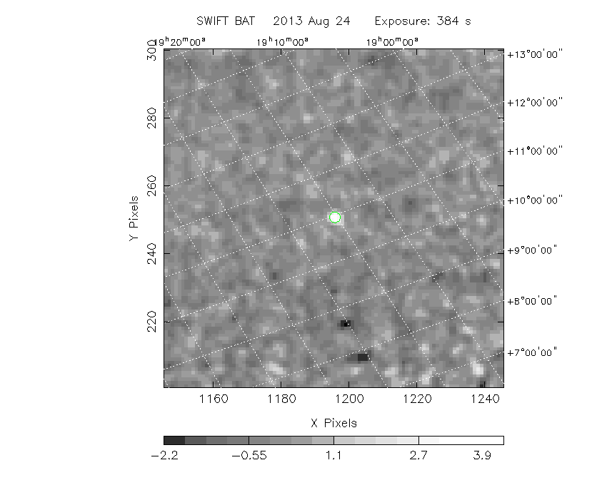
The green circle (6 arcmin radius) is the BAT position (RA, Dec) = (288.805, +10.956).
Search BAT source with the INTEGRAL catalog
known_source_INTEGRAL.sh 288.805 +10.956 1.0
GRS1915+105     ( 288.798 ,  10.946 )     delta= 0.012
Results of batcelldetect
# RAcent  DECcent POSerr Theta    Phi  PeakCts   SNR AngSep     Name
#  [deg]    [deg]    ['] [deg]  [deg]                   [']
  7.2036  59.2894    0.0  35.6  -29.3   0.0099   0.0    0.0	V709 Cas
 19.5112  65.2916    0.0  41.2  -39.2  -0.0426  -0.1    0.0	4U 0114+65
254.4576  35.3425    0.0  44.8 -155.3   0.7491   2.0    0.0	Her X-1
278.7590  32.6973    0.0  28.8 -176.7  -0.2063  -0.9    0.0	3C 382
279.9896   5.0358    0.0  48.7  151.3   0.1696   0.2    0.0	Ser X-1
287.4138   9.8292    0.0  40.9  145.5   0.7904   1.6    0.0	4U 1907+09
287.7208   7.6667    0.0  42.6  143.6   0.0959   0.2    0.0	4U 1909+07
287.9565   4.9827    0.0  45.0  141.6   0.7311   0.9    0.0	SS 433
288.5083   9.8883    0.0  40.3  144.1  -0.3262  -0.7    0.0	IGR J19140+0951
288.7983  10.9456    0.0  39.2  144.5   4.5011  10.2    0.0	GRS 1915+105
297.3771  30.2067    0.0  18.6  151.4  -0.1852  -0.9    0.0	KS 1947+300
298.9292  32.1000    0.0  16.3  151.8   0.4589   2.3    0.0	4U 1954+31
299.5903  35.2016    0.0  13.6  158.0   1.8216   9.2    0.0	Cyg X-1
299.8682  40.7339    0.0  10.2  179.5  -0.1011  -0.5    0.0	Cyg A
308.0633  37.6375    0.0   7.5  135.5  -0.0461  -0.2    0.0	EXO 2030+375
308.1103  40.9526    0.0   4.8  153.5   3.1394  15.8    0.0	Cyg X-3
314.6979  41.7770    0.0   2.8   76.3   0.2429   1.3    0.0	GRO J2058+42
321.1638  50.9739    0.0   8.7  -38.1  -0.0653  -0.3    0.0	IGR J21247+5058
322.4929  12.1674    0.0  33.1   87.8   0.4008   0.8    0.0	4U 2129+12
323.4320  51.1236    0.0   9.9  -32.6  -0.3177  -1.5    0.0	RX J2133.7+5107
326.1717  38.3217    0.0  11.6   41.4   0.5432   2.8    0.0	Cyg X-2
331.9808  54.5197    0.0  16.0  -31.4  -0.1647  -0.8    0.0	4U 2206+54
343.4906  16.1482    0.0  38.2   52.9   0.0465   0.1    0.0	3C 454.3
350.9671  42.1830    0.0  27.6    6.0   0.4940   2.1    0.0	1ES 2321+419
  3.0576  45.2975    2.9  35.1   -4.6   1.0676   4.0 ------	UNKNOWN
 49.0654  62.7204    2.0  54.2  -40.6  11.6482   5.9 ------	UNKNOWN
Search for the BAT bright source catalog
# RAcent  DECcent POSerr Theta    Phi  PeakCts   SNR AngSep     Name
#  [deg]    [deg]    ['] [deg]  [deg]                   [']
254.4576  35.3425    0.0  44.8 -155.3   0.7491   2.0    0.0	Her X-1
288.7983  10.9456    0.0  39.2  144.5   4.5006  10.3    0.0	GRS 1915+105
299.5903  35.2016    0.0  13.6  158.0   1.8221   8.9    0.0	Cyg X-1
308.1103  40.9526    0.0   4.8  153.5   3.1394  15.8    0.0	Cyg X-3
326.1717  38.3217    0.0  11.6   41.4   0.5432   2.8    0.0	Cyg X-2
  3.0576  45.2975    2.9  35.1   -4.6   1.0676   4.0 ------	UNKNOWN
 49.0654  62.7204    2.0  54.2  -40.6  11.6482   5.9 ------	UNKNOWN

Search for UNKNOWN source R.A. = 3.0576 Dec. = +45.2975 (search radius of 3 degrees)
No bright source found.

Search for UNKNOWN source R.A. = 49.0654 Dec. = +62.7204 (search radius of 3 degrees)
No bright source found.
Result of batcelldetect cleaning the bright sources
# RAcent  DECcent POSerr Theta    Phi  PeakCts   SNR AngSep     Name
#  [deg]    [deg]    ['] [deg]  [deg]                   [']
  7.2036  59.2894    0.0  35.6  -29.3   0.0765   0.3    0.0	V709 Cas
 19.5112  65.2916    0.0  41.2  -39.2   0.0056   0.0    0.0	4U 0114+65
254.4576  35.3425    0.0  44.8 -155.3   0.4996   1.5    0.0	Her X-1
278.7590  32.6973    0.0  28.8 -176.7  -0.2224  -1.1    0.0	3C 382
279.9896   5.0358    0.0  48.7  151.3  -0.0795  -0.1    0.0	Ser X-1
287.4138   9.8292    0.0  40.9  145.5   1.0871   2.4    0.0	4U 1907+09
287.7208   7.6667    0.0  42.6  143.6   0.5755   1.0    0.0	4U 1909+07
287.9565   4.9827    0.0  45.0  141.6   0.4493   0.7    0.0	SS 433
288.5083   9.8883    0.0  40.3  144.1  -0.2462  -0.5    0.0	IGR J19140+0951
288.7983  10.9456    0.0  39.2  144.5   2.8211   7.1    0.0	GRS 1915+105
297.3771  30.2067    0.0  18.6  151.4  -0.0778  -0.4    0.0	KS 1947+300
298.9292  32.1000    0.0  16.3  151.8   0.4000   2.1    0.0	4U 1954+31
299.5903  35.2016    0.0  13.6  158.0  -5.3687 -29.9    0.0	Cyg X-1
299.8682  40.7339    0.0  10.2  179.5   0.1161   0.7    0.0	Cyg A
308.0633  37.6375    0.0   7.5  135.5  -0.0986  -0.5    0.0	EXO 2030+375
308.1103  40.9526    0.0   4.8  153.5  -2.2825 -12.2    0.0	Cyg X-3
314.6979  41.7770    0.0   2.8   76.3   0.0833   0.5    0.0	GRO J2058+42
321.1638  50.9739    0.0   8.7  -38.1  -0.0036  -0.0    0.0	IGR J21247+5058
322.4929  12.1674    0.0  33.1   87.8   0.2561   0.6    0.0	4U 2129+12
323.4320  51.1236    0.0   9.9  -32.6  -0.3049  -1.8    0.0	RX J2133.7+5107
326.1717  38.3217    0.0  11.6   41.4   0.8113   4.3    0.0	Cyg X-2
331.9808  54.5197    0.0  16.0  -31.4   0.0579   0.3    0.0	4U 2206+54
343.4906  16.1482    0.0  38.2   52.9  -0.4712  -1.0    0.0	3C 454.3
350.9671  42.1830    0.0  27.6    6.0   0.4201   1.9    0.0	1ES 2321+419
253.6618  12.0181    2.1  59.7 -178.2  12.7647   5.5 ------	UNKNOWN
281.6323  49.4121    2.2  21.8 -140.1   0.9561   5.4 ------	UNKNOWN
 46.4599  48.1985    2.3  60.6  -25.1  10.7157   5.0 ------	UNKNOWN
DPI of the combined detector enable/disable map (archived enable/disable map + downloaded data)

DPI of the scaled map

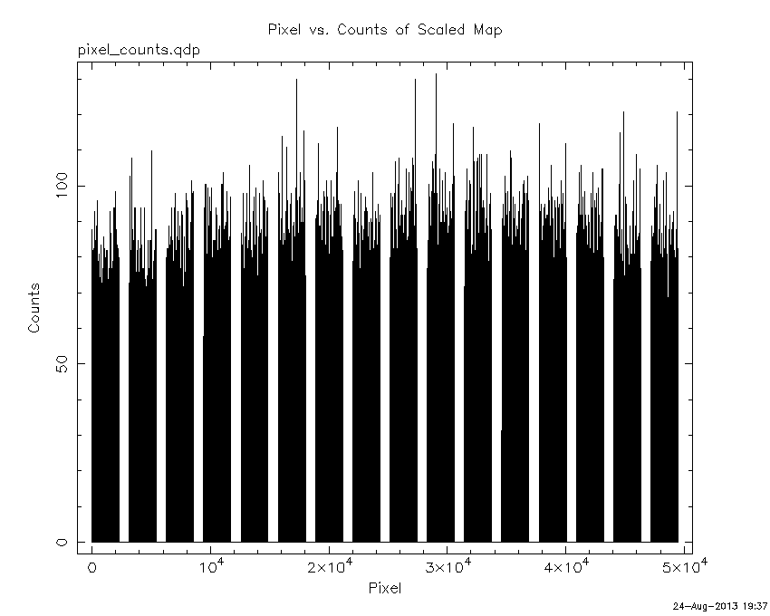
Pixel vs. Counts plot
The data/results are in /local/data/raid2/prebascript/trigger567383/tdrss_ql/

bat_scaledmap.fits : TDRSS FITS scaled map from GCN
source.img         : Sky FITS image of the scaled map (batfftimage)
source.list        : FITS list of the detected sources (batcelldetect)
scaledmap.log      : Ascii output of the analysis log
bat_pos.reg        : region file for ds9
source.gif         : GIF sky image

Processed time:
Sat Aug 24 19:37:14 EDT 2013