TDRSS scaled map for 638808
GCN BAT Position Notice
TITLE:           GCN/SWIFT NOTICE
NOTICE_DATE:     Thu 23 Apr 15 06:28:24 UT
NOTICE_TYPE:     Swift-BAT GRB Position
TRIGGER_NUM:     638808,   Seg_Num: 0
GRB_RA:          221.600d {+14h 46m 24s} (J2000),
                 221.784d {+14h 47m 08s} (current),
                 221.000d {+14h 44m 00s} (1950)
GRB_DEC:         +12.288d {+12d 17' 18"} (J2000),
                 +12.225d {+12d 13' 29"} (current),
                 +12.497d {+12d 29' 51"} (1950)
GRB_ERROR:       3.00 [arcmin radius, statistical only]
GRB_INTEN:       1480 [cnts]    Image_Peak=148 [image_cnts]
TRIGGER_DUR:     0.256 [sec]
TRIGGER_INDEX:   126     E_range: 50-350 keV
BKG_INTEN:       16328 [cnts]
BKG_TIME:        23274.51 SOD {06:27:54.51} UT
BKG_DUR:         8 [sec]
GRB_DATE:        17135 TJD;   113 DOY;   15/04/23
GRB_TIME:        23284.69 SOD {06:28:04.69} UT
GRB_PHI:          57.60 [deg]
GRB_THETA:        12.32 [deg]
SOLN_STATUS:     0x3
RATE_SIGNIF:     41.24 [sigma]
IMAGE_SIGNIF:    10.41 [sigma]
MERIT_PARAMS:     +1  +0  +0  -2  +3  +0  +0  +0 +89  +0
SUN_POSTN:        30.59d {+02h 02m 23s}  +12.44d {+12d 26' 32"}
SUN_DIST:        152.95 [deg]   Sun_angle= 11.3 [hr] (West of Sun)
MOON_POSTN:       91.34d {+06h 05m 21s}  +18.24d {+18d 14' 22"}
MOON_DIST:       122.41 [deg]
MOON_ILLUM:      24 [%]
GAL_COORDS:        9.75, 59.26 [deg] galactic lon,lat of the burst (or transient)
ECL_COORDS:      214.94, 26.96 [deg] ecliptic lon,lat of the burst (or transient)
COMMENTS:        SWIFT-BAT GRB Coordinates.
COMMENTS:        This is a rate trigger.
COMMENTS:        A point_source was found.
COMMENTS:        This does not match any source in the on-board catalog.
COMMENTS:        This does not match any source in the ground catalog.
COMMENTS:        This is a GRB.
COMMENTS:        This trigger occurred at longitude,latitude = 287.46,5.11 [deg].
GCN BAT Scaled Map Notice
TITLE:           GCN/SWIFT NOTICE
NOTICE_DATE:     Thu 23 Apr 15 06:37:40 UT
NOTICE_TYPE:     Swift-BAT Scaled Map
TRIGGER_NUM:     638808,   Seg_Num: 0
POINT_RA:        216.797d {+14h 27m 11s} (J2000)
POINT_DEC:       +23.748d {+23d 44' 52"} (J2000)
MAP_DATE:        17135 TJD;   113 DOY;   15/04/23
MAP_TIME:        23284.69 SOD {06:28:04.69} UT
TRIGGER_DUR:     0.256 [sec]
SOLN_STATUS:     0x3
RATE_SIGNIF:     41.24 [sigma]
IMAGE_SIGNIF:    10.41 [sigma]
MAP_URL:         sw00638808000msbsm.fits
SUN_POSTN:        30.60d {+02h 02m 24s}  +12.44d {+12d 26' 39"}
MOON_POSTN:       91.42d {+06h 05m 42s}  +18.24d {+18d 14' 14"}
MOON_ILLUM:      24 [%]
GAL_COORDS:       29.38, 68.15 [deg] galactic lon,lat of the pointing direction
ECL_COORDS:      205.07, 35.98 [deg] ecliptic lon,lat of the pointing direction
COMMENTS:        SWIFT-BAT Scaled Map.
COMMENTS:
COMMENTS:        The next comments were copied from the BAT_POS Notice:
Scaled map image
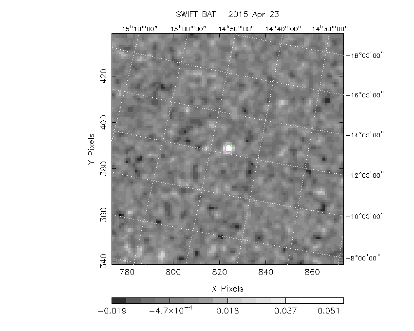
The green circle (6 arcmin radius) is the BAT position (RA, Dec) = (221.600, +12.288).
Search BAT source with the INTEGRAL catalog
known_source_INTEGRAL.sh 221.600 +12.288 1.0
1RXSJ144701.1+114536 ( 221.755 ,  11.760 )     delta= 0.549
Results of batcelldetect
# RAcent  DECcent POSerr Theta    Phi  PeakCts   SNR AngSep     Name
#  [deg]    [deg]    ['] [deg]  [deg]                   [']
169.5454  48.0369    0.0  44.4 -144.5   0.0010   0.1    0.0	XTE J1118+480
182.6357  39.4057    0.0  32.8 -153.2  -0.0124  -1.9    0.0	NGC 4151
186.4448  12.6621    0.0  30.8  154.4   0.0028   0.4    0.0	NGC 4388
187.2779   2.0524    0.0  35.9  137.3  -0.0134  -1.2    0.0	3C 273
213.3119  -3.2075    0.0  27.2   87.7  -0.0027  -0.3    0.0	NGC 5506
244.9795 -15.6402    0.0  48.1   42.4   0.0068   0.2    0.0	Sco X-1
254.4576  35.3425    0.0  34.5  -38.3   0.0035   0.5    0.0	Her X-1
278.7590  32.6973    0.0  54.6  -34.2  -0.0307  -1.0    0.0	3C 382
221.6094  12.2808    1.1  12.3   57.6   0.0609  10.5 ------	UNKNOWN
283.4425  20.8766    1.8  61.1  -21.6   0.5851   6.3 ------	UNKNOWN
Search for the BAT bright source catalog
# RAcent  DECcent POSerr Theta    Phi  PeakCts   SNR AngSep     Name
#  [deg]    [deg]    ['] [deg]  [deg]                   [']
244.9795 -15.6402    0.0  48.1   42.4   0.0068   0.2    0.0	Sco X-1
254.4576  35.3425    0.0  34.5  -38.3   0.0035   0.5    0.0	Her X-1
268.3680  -1.4526    0.0  56.0    9.3  -0.0093  -0.3    0.0	SW J1753.5-0127
221.6094  12.2808    1.1  12.3   57.6   0.0609  10.5 ------	UNKNOWN
283.4425  20.8766    1.8  61.1  -21.6   0.5851   6.3 ------	UNKNOWN

Search for UNKNOWN source R.A. = 221.6094 Dec. = +12.2808 (search radius of 3 degrees)
No bright source found.

Search for UNKNOWN source R.A. = 283.4425 Dec. = +20.8766 (search radius of 3 degrees)
No bright source found.
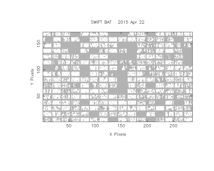
DPI of the combined detector enable/disable map (archived enable/disable map + downloaded data)
DPI of the scaled map

Pixel vs. Counts plot

The data/results are in /local/data/bat1/prebascript/trigger638808/tdrss_ql/

bat_scaledmap.fits : TDRSS FITS scaled map from GCN
source.img         : Sky FITS image of the scaled map (batfftimage)
source.list        : FITS list of the detected sources (batcelldetect)
scaledmap.log      : Ascii output of the analysis log
bat_pos.reg        : region file for ds9
source.gif         : GIF sky image

Processed time:
Thu Apr 23 02:38:19 EDT 2015