TDRSS scaled map for 652824
GCN BAT Position Notice
TITLE:           GCN/SWIFT NOTICE
NOTICE_DATE:     Fri 21 Aug 15 02:26:03 UT
NOTICE_TYPE:     Swift-BAT GRB Position
TRIGGER_NUM:     652824,   Seg_Num: 0
GRB_RA:           10.241d {+00h 40m 58s} (J2000),
                  10.455d {+00h 41m 49s} (current),
                   9.559d {+00h 38m 14s} (1950)
GRB_DEC:         +41.081d {+41d 04' 51"} (J2000),
                 +41.166d {+41d 09' 59"} (current),
                 +40.806d {+40d 48' 23"} (1950)
GRB_ERROR:       4.00 [arcmin radius, statistical only]
GRB_INTEN:       0 [cnts]    Image_Peak=2671 [image_cnts]
TRIGGER_DUR:     448.000 [sec]   (=7.5 [min])
TRIGGER_INDEX:   20000     E_range: 15-50 keV
BKG_INTEN:       0 [cnts]
BKG_TIME:        0.00 SOD {00:00:00.00} UT
BKG_DUR:         0 [sec]
GRB_DATE:        17255 TJD;   233 DOY;   15/08/21
GRB_TIME:        8248.97 SOD {02:17:28.97} UT
GRB_PHI:         -173.01 [deg]
GRB_THETA:        43.62 [deg]
SOLN_STATUS:     0x1099D
RATE_SIGNIF:     0.00 [sigma]
IMAGE_SIGNIF:    6.04 [sigma]
MERIT_PARAMS:     +0  +0 +125  +8  +1  -5  +0  +0 +42  +1
SUN_POSTN:       149.93d {+09h 59m 43s}  +12.26d {+12d 15' 20"}
SUN_DIST:        114.80 [deg]   Sun_angle= 9.3 [hr] (West of Sun)
MOON_POSTN:      217.14d {+14h 28m 34s}  -11.27d {-11d 16' 16"}
MOON_DIST:       142.03 [deg]
MOON_ILLUM:      34 [%]
GAL_COORDS:      120.81,-21.75 [deg] galactic lon,lat of the burst (or transient)
ECL_COORDS:       27.39, 33.34 [deg] ecliptic lon,lat of the burst (or transient)
COMMENTS:        SWIFT-BAT GRB Coordinates.
COMMENTS:        This Notice was delayed by more than 60 sec past the end of the trigger integration interval;
COMMENTS:        probably due to it occurring during a Malindi downlink session.
COMMENTS:        This is an image trigger.  (The RATE_SIGNIF & BKG_{INTEN, TIME, DUR} are undefined.)
COMMENTS:        A point_source was found.
COMMENTS:        This is a low-flux event whose position matches one of the nearby galaxy sources in the on-board catalog!
COMMENTS:        This matches a source in the on-board catalog: Num=14051=M31_-1,-1,   delta=0.157 [deg].
COMMENTS:        This matches a source in the ground catalog: M31_-1,-2,   delta=0.121 [deg].
COMMENTS:        The position is inside the galaxy NGC224 (of total mag=3.50 and dia=178.00 arcmin).
GCN BAT Scaled Map Notice
TITLE:           GCN/SWIFT NOTICE
NOTICE_DATE:     Fri 21 Aug 15 02:32:41 UT
NOTICE_TYPE:     Swift-BAT Scaled Map
TRIGGER_NUM:     652824,   Seg_Num: 0
POINT_RA:          0.000d {+00h 00m 00s} (J2000)
POINT_DEC:        +0.000d {+00d 00' 00"} (J2000)
MAP_DATE:        17255 TJD;   233 DOY;   15/08/21
MAP_TIME:        8248.97 SOD {02:17:28.97} UT
TRIGGER_DUR:     448.000 [sec]   (=7.5 [min])
SOLN_STATUS:     0x99D
RATE_SIGNIF:     0.00 [sigma]
IMAGE_SIGNIF:    6.04 [sigma]
MAP_URL:         sw00652824000msbsm.fits
SUN_POSTN:       149.93d {+09h 59m 44s}  +12.25d {+12d 15' 15"}
MOON_POSTN:      217.20d {+14h 28m 47s}  -11.29d {-11d 17' 05"}
MOON_ILLUM:      34 [%]
GAL_COORDS:       96.34,-60.19 [deg] galactic lon,lat of the pointing direction
ECL_COORDS:        0.00,  0.00 [deg] ecliptic lon,lat of the pointing direction
COMMENTS:        SWIFT-BAT Scaled Map.
COMMENTS:        WARNING: This Notice was received with 1 (or more) critical values out of range.
COMMENTS:
Scaled map image
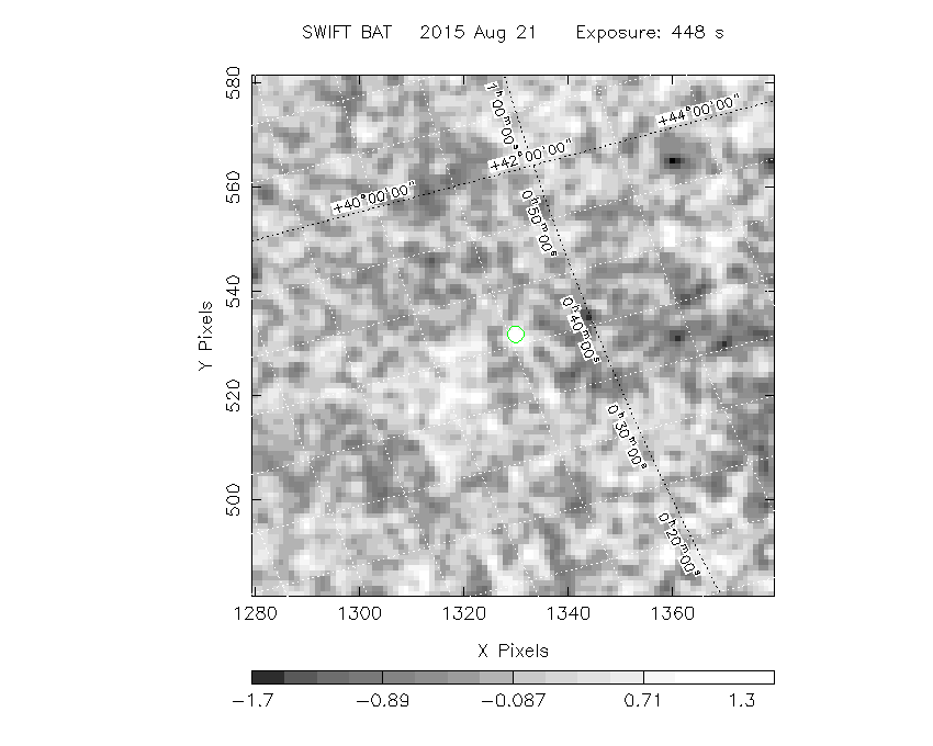
The green circle (6 arcmin radius) is the BAT position (RA, Dec) = (10.241, +41.081).
Search BAT source with the INTEGRAL catalog
known_source_INTEGRAL.sh 10.241 +41.081 1.0
4U0037+39       (  10.646 ,  41.162 )     delta= 0.315
Mrk957          (  10.470 ,  40.355 )     delta= 0.747
XMMUJ004245.2+411721 (  10.688 ,  41.289 )     delta= 0.396
XMMUJ004308.5+411820 (  10.785 ,  41.306 )     delta= 0.467
XMMUJ004414.0+412204 (  11.058 ,  41.368 )     delta= 0.678
XMMUJ004415.9+413058 (  11.066 ,  41.516 )     delta= 0.757
XMMUJ004438.1+414511 (  11.159 ,  41.753 )     delta= 0.962
Results of batcelldetect
# RAcent  DECcent POSerr Theta    Phi  PeakCts   SNR AngSep     Name
#  [deg]    [deg]    ['] [deg]  [deg]                   [']
343.4906  16.1482    0.0  38.4  134.7  -0.6737  -1.2    0.0	3C 454.3
350.9671  42.1830    0.0  50.4  169.5   0.4126   0.6    0.0	1ES 2321+419
 58.3225 -46.0199    3.2  56.5  -17.6   3.5241   3.6 ------	UNKNOWN
 42.8224  48.9597    3.1  55.4 -145.0   7.0279   3.7 ------	UNKNOWN
 67.1533 -27.0748    2.8  53.5  -42.1   8.8298   4.1 ------	UNKNOWN
Search for the BAT bright source catalog
# RAcent  DECcent POSerr Theta    Phi  PeakCts   SNR AngSep     Name
#  [deg]    [deg]    ['] [deg]  [deg]                   [']
 58.3225 -46.0199    3.2  56.5  -17.6   3.5241   3.6 ------	UNKNOWN
 42.8224  48.9597    3.1  55.4 -145.0   7.0279   3.7 ------	UNKNOWN
 67.1533 -27.0748    2.8  53.5  -42.1   8.8298   4.1 ------	UNKNOWN

Search for UNKNOWN source R.A. = 42.8224 Dec. = +48.9597 (search radius of 3 degrees)
No bright source found.

Search for UNKNOWN source R.A. = 58.3225 Dec. = -46.0199 (search radius of 3 degrees)
No bright source found.

Search for UNKNOWN source R.A. = 67.1533 Dec. = -27.0748 (search radius of 3 degrees)
No bright source found.
Result of batcelldetect cleaning the bright sources
# RAcent  DECcent POSerr Theta    Phi  PeakCts   SNR AngSep     Name
#  [deg]    [deg]    ['] [deg]  [deg]                   [']
343.4906  16.1482    0.0  38.4  134.7  -0.0191  -0.0    0.0	3C 454.3
350.9671  42.1830    0.0  50.4  169.5   0.6667   1.0    0.0	1ES 2321+419
 10.2018  41.0914    1.7  43.6 -173.1   2.2610   6.7 ------	UNKNOWN
 43.0534 -36.8702    2.1  41.9  -15.5   1.5874   5.4 ------	UNKNOWN
 33.0056  13.2229    2.4  21.5 -120.4   1.1082   4.8 ------	UNKNOWN
 67.4942 -43.9713    2.2  60.7  -23.8  11.6950   5.3 ------	UNKNOWN
 40.9340  54.5278    2.5  59.7 -149.5  10.7348   4.6 ------	UNKNOWN
DPI of the combined detector enable/disable map (archived enable/disable map + downloaded data)

DPI of the scaled map

Pixel vs. Counts plot

The data/results are in /local/data/bat1/prebascript/trigger652824/tdrss_ql/

bat_scaledmap.fits : TDRSS FITS scaled map from GCN
source.img         : Sky FITS image of the scaled map (batfftimage)
source.list        : FITS list of the detected sources (batcelldetect)
scaledmap.log      : Ascii output of the analysis log
bat_pos.reg        : region file for ds9
source.gif         : GIF sky image

Processed time:
Thu Aug 20 22:33:30 EDT 2015