TDRSS scaled map for 823001
GCN BAT Position Notice
TITLE:           GCN/SWIFT NOTICE
NOTICE_DATE:     Sat 07 Apr 18 01:55:37 UT
NOTICE_TYPE:     Swift-BAT GRB Position
TRIGGER_NUM:     823001,   Seg_Num: 0
GRB_RA:           35.241d {+02h 20m 58s} (J2000),
                  35.514d {+02h 22m 03s} (current),
                  34.495d {+02h 17m 59s} (1950)
GRB_DEC:         +33.499d {+33d 29' 56"} (J2000),
                 +33.582d {+33d 34' 54"} (current),
                 +33.270d {+33d 16' 14"} (1950)
GRB_ERROR:       3.00 [arcmin radius, statistical only]
GRB_INTEN:       16130 [cnts]    Image_Peak=422 [image_cnts]
TRIGGER_DUR:     4.096 [sec]
TRIGGER_INDEX:   291     E_range: 15-50 keV
BKG_INTEN:       145632 [cnts]
BKG_TIME:        6835.25 SOD {01:53:55.25} UT
BKG_DUR:         40 [sec]
GRB_DATE:        18215 TJD;    97 DOY;   18/04/07
GRB_TIME:        6889.78 SOD {01:54:49.78} UT
GRB_PHI:         -98.28 [deg]
GRB_THETA:        25.74 [deg]
SOLN_STATUS:     0x3
RATE_SIGNIF:     7.74 [sigma]
IMAGE_SIGNIF:    9.45 [sigma]
MERIT_PARAMS:     +1  +0  +0  +2  +1  +0 -100  +0 -84  +0
SUN_POSTN:        15.87d {+01h 03m 28s}   +6.76d {+06d 45' 33"}
SUN_DIST:         32.41 [deg]   Sun_angle= -1.3 [hr] (East of Sun)
MOON_POSTN:      274.15d {+18h 16m 37s}  -20.20d {-20d 12' 08"}
MOON_DIST:       126.72 [deg]
MOON_ILLUM:      62 [%]
GAL_COORDS:      143.58,-25.76 [deg] galactic lon,lat of the burst (or transient)
ECL_COORDS:       44.14, 18.36 [deg] ecliptic lon,lat of the burst (or transient)
COMMENTS:        SWIFT-BAT GRB Coordinates.
COMMENTS:        This is a rate trigger.
COMMENTS:        A point_source was found.
COMMENTS:        This does not match any source in the on-board catalog.
COMMENTS:        This does not match any source in the ground catalog.
COMMENTS:        This is a GRB.
COMMENTS:        This trigger occurred at longitude,latitude = 176.17,6.89 [deg].
GCN BAT Scaled Map Notice
TITLE:           GCN/SWIFT NOTICE
NOTICE_DATE:     Sat 07 Apr 18 02:04:10 UT
NOTICE_TYPE:     Swift-BAT Scaled Map
TRIGGER_NUM:     823001,   Seg_Num: 0
POINT_RA:         57.419d {+03h 49m 40s} (J2000)
POINT_DEC:       +53.932d {+53d 55' 56"} (J2000)
MAP_DATE:        18215 TJD;    97 DOY;   18/04/07
MAP_TIME:        6889.78 SOD {01:54:49.78} UT
TRIGGER_DUR:     4.096 [sec]
SOLN_STATUS:     0x3
RATE_SIGNIF:     7.74 [sigma]
IMAGE_SIGNIF:    9.45 [sigma]
MAP_URL:         sw00823001000msbsm.fits
SUN_POSTN:        15.87d {+01h 03m 30s}   +6.76d {+06d 45' 41"}
MOON_POSTN:      274.23d {+18h 16m 55s}  -20.21d {-20d 12' 18"}
MOON_ILLUM:      62 [%]
GAL_COORDS:      147.33, -0.27 [deg] galactic lon,lat of the pointing direction
ECL_COORDS:       67.80, 32.98 [deg] ecliptic lon,lat of the pointing direction
COMMENTS:        SWIFT-BAT Scaled Map.
COMMENTS:
COMMENTS:        The next comments were copied from the BAT_POS Notice:
Scaled map image
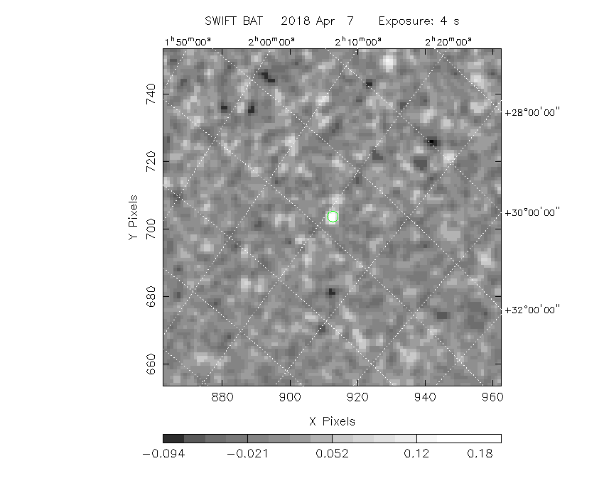
The green circle (6 arcmin radius) is the BAT position (RA, Dec) = (35.241, +33.499).
Search BAT source with the INTEGRAL catalog
known_source_INTEGRAL.sh 35.241 +33.499 1.0
No source found
Results of batcelldetect
# RAcent  DECcent POSerr Theta    Phi  PeakCts   SNR AngSep     Name
#  [deg]    [deg]    ['] [deg]  [deg]                   [']
  7.2036  59.2894    0.0  27.4  -23.1  -0.0157  -0.9    0.0	V709 Cas
 19.5112  65.2916    0.0  21.8   -8.5   0.0012   0.1    0.0	4U 0114+65
 52.8001  43.9046    0.0  10.5 -126.1   0.0115   0.8    0.0	GK Per
 53.7495  53.1732    0.0   2.3  -72.7  -0.0130  -0.8    0.0	V0332+53
 58.8458  31.0497    0.0  22.9 -147.9  -0.0293  -1.8    0.0	X Per
 83.6332  22.0145    0.0  37.6  173.1   0.0067   0.3    0.0	Crab
 93.9015  71.0375    0.0  23.3   64.5  -0.0374  -1.5    0.0	Mkn 3
 94.2804   9.1370    0.0  53.6  167.9  -0.0554  -0.8    0.0	4U 0614+091
166.6979  72.5686    0.0  44.5   59.1  -0.0327  -0.3    0.0	NGC 3516
321.1638  50.9739    0.0  54.0  -15.4   0.0759   1.5    0.0	IGR J21247+5058
323.4320  51.1236    0.0  52.9  -16.5  -0.0172  -0.4    0.0	RX J2133.7+5107
331.9808  54.5197    0.0  46.7  -17.3  -0.0389  -1.2    0.0	4U 2206+54
350.9671  42.1830    0.0  44.2  -41.8   0.0487   1.3    0.0	1ES 2321+419
132.1119  59.6964    2.2  39.1   85.8   0.3301   5.2 ------	UNKNOWN
100.7742  29.8492    1.7  39.3  145.3   0.2655   6.8 ------	UNKNOWN
 68.5874  88.5798    3.0  34.7   35.8   0.1258   4.0 ------	UNKNOWN
 75.0582  88.2245    3.0  34.4   36.3   0.1487   4.8 ------	UNKNOWN
 89.4609   4.5229    2.6  55.9  175.6   0.3739   4.5 ------	UNKNOWN
 35.2317  33.5231    1.2  25.7  -98.2   0.2299   9.3 ------	UNKNOWN
 14.6260  36.7227    2.3  33.9  -67.5   0.1463   5.1 ------	UNKNOWN
Search for the BAT bright source catalog
# RAcent  DECcent POSerr Theta    Phi  PeakCts   SNR AngSep     Name
#  [deg]    [deg]    ['] [deg]  [deg]                   [']
 83.6332  22.0145    0.0  37.6  173.1   0.0067   0.3    0.0	Crab
132.1119  59.6964    2.2  39.1   85.8   0.3301   5.2 ------	UNKNOWN
100.7742  29.8492    1.7  39.3  145.3   0.2655   6.8 ------	UNKNOWN
 68.5874  88.5798    3.0  34.7   35.8   0.1258   4.0 ------	UNKNOWN
 75.0582  88.2245    3.0  34.4   36.3   0.1487   4.8 ------	UNKNOWN
 89.4609   4.5229    2.6  55.9  175.6   0.3739   4.5 ------	UNKNOWN
 35.2317  33.5231    1.2  25.7  -98.2   0.2299   9.3 ------	UNKNOWN
 14.6260  36.7227    2.3  33.9  -67.5   0.1463   5.1 ------	UNKNOWN

Search for UNKNOWN source R.A. = 14.6260 Dec. = +36.7227 (search radius of 3 degrees)
No bright source found.

Search for UNKNOWN source R.A. = 35.2317 Dec. = +33.5231 (search radius of 3 degrees)
No bright source found.

Search for UNKNOWN source R.A. = 68.5874 Dec. = +88.5798 (search radius of 3 degrees)
No bright source found.

Search for UNKNOWN source R.A. = 75.0582 Dec. = +88.2245 (search radius of 3 degrees)
No bright source found.

Search for UNKNOWN source R.A. = 89.4609 Dec. = +4.5229 (search radius of 3 degrees)
No bright source found.

Search for UNKNOWN source R.A. = 100.7742 Dec. = +29.8492 (search radius of 3 degrees)
No bright source found.

Search for UNKNOWN source R.A. = 132.1119 Dec. = +59.6964 (search radius of 3 degrees)
No bright source found.
DPI of the combined detector enable/disable map (archived enable/disable map + downloaded data)
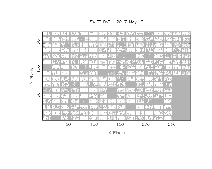
DPI of the scaled map

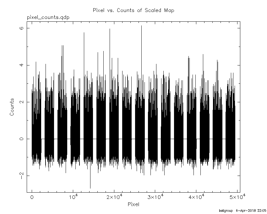
Pixel vs. Counts plot
The data/results are in /local/data/bat1/prebascript/trigger823001/tdrss_ql/

bat_scaledmap.fits : TDRSS FITS scaled map from GCN
source.img         : Sky FITS image of the scaled map (batfftimage)
source.list        : FITS list of the detected sources (batcelldetect)
scaledmap.log      : Ascii output of the analysis log
bat_pos.reg        : region file for ds9
source.gif         : GIF sky image

Processed time:
Fri Apr  6 22:05:38 EDT 2018