
Return to: UVOT Digest
Distortion Map
Updated September 14, 2010The distortion maps in the UVW2 teldef files that were released in the 20100430 version of the Swift/UVOTA CalDB contain an error in the UVOT plate scale. This error will result in small astrometric errors in the UVOT UVW2 SKY images. These errors will be negligible near the boresight position, but will increase as one moves towards the edges of the field, and may prevent the determination of an aspect solution. New UVW2 teldef files will be released in early October 2010. These files will contain corrected distortion maps.
These erroneous teldef files were never used in the pipeline, and will only affect users who reprocess their data from the raw images. The data in the Swift Data Archive are not affected by this problem.
The UVOT distortion between raw and detector coordinates in recorded in the "teldef" file in caldb. The current teldef file, based on the ground-measured distortion, is working well. For 583 stars in the calibration field referred to as "Sally's field" the median difference between the catalog position and the position measured on the sky image is 0.327′ with only a modest deterioration as one moves from the image center.
An interpolation scheme is used to convert from a grid of distortion offsets to any position on the detector. The current interpolation scheme is a "thin spline" approximation. This choice affects the photometry at the level of about 4 percent. The UVOT calibration team is currently studying alternative interpolation schemes to see if this can be improved upon.
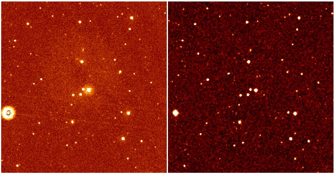
| Left: 100 s UVOT v image. Right: Digitized Sky Survey of same region. |
 |
At the start of the mission the plate scale for all the UVOT lenticular filters was assumed to be the same. In fact, the scale for UVW2 is significantly different than the rest. The result for this filter was larger position errors and more frequent failures of the automated aspect correction in the pipeline.
On September 13, 2006, CALDB was changed to correct for this. There is now a separate teldef file per filter, each with its own plate scale.
The first corrected CALDB version is u20060913. The CALDB version is stored in the data using the CALDBVER keyword, with a string that contains "_udate_" where date is an 8-digit value in yyyymmdd format.
The first version of the processing pipeline to use this CALDB was 3.7. The keyword PROCVER, which appears in all Swift science files, records the version of the pipeline used in processing.
The distortion map is known to produce an unphysical pattern of stripes at a level of approximately 1%. The large-scale behaviour of the sky, however, is correctly modelled. The cause of the stripe pattern is unknown, but we think that is may be an artifact of the ground calibration of the UVOTA distortion map. These stripes introduce photometric errors of approximately 1% for bright sources. The affect on faint sources may be larger. The stripes may also introduce astrometric errors of approximately 0.125 arcseconds. Work is in progress to understand the cause of these stripes and how to remove them.
Return to: UVOT Digest

- Curator: J.D. Myers
- NASA Official & Swift PI: Brad Cenko
- PAO Contact: Francis Reddy
- Questions/Comments/Feedback
- › Privacy Policy and Important Notices
- › Accessibility
- › Contact NASA
- › Page Last Updated: Tue, Mar 20, 2012